Wednesday, September 4, 2013

Auto Bell Car Wash, Hampton & Noland Trail, Newport News, VA

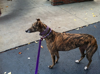
I'm still on my "Stay-cation" so this morning the dogs and I took the van for a much-needed car wash! The dog-friendly Auto Bell Car Wash is on North Armistead Avenue in Hampton.
The young men who work here are so courteous and they seem to enjoy the visit by the greyhounds.
The dogs didn't seem to want to wait for the van to go by the window--they preferred to wait outside.
And out comes the van!
While we were waiting for them to dry the van off, PG heard some popping sounds and started shaking. I"m pretty sure it was the firing range at Langley Air Force Base. I looked up the Joint Base Langley-Eustis bulletin for today and it said, "Off-limits area
The Langley Air Force Base combat arms range and the bullet impact area to the rear of the range are off limits to all personnel. Due to live-fire of weapons, trespassing in this area is illegal and dangerous."
She was happy to get into the safety of the clean van and head to our next adventure!
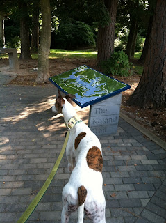
We headed for the Noland Trail in Newport News. From I64, take Exit 258-A. Travel 2.5 miles to the intersection of Warwick Blvd. and J. Clyde Morris Blvd. (also called Avenue of the Arts). Continue straight through the intersection and turn left onto Museum Drive. There is a parking lot on the right hand side for the Noland Trail's North Entrance.
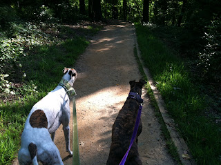
The Noland Trail is 5 miles long along the shoreline of Lake Maury. It has many elevation changes so it is a challenging walk. Lots of students from nearby Christopher Newport University use it as a jogging trail. There are mile markers all along the trail--we walked for a mile and then turned around--for a 2 mile long walk--rather than go the whole 5 miles.
Lake Maury is really picturesque--named for the famed 19th-century oceanographer and native Virginian, Matthew Fontaine Maury. It was such a glorious morning, cool and not humid. Every once in a while Sammy would prance up on  his toes and bark out loud when we were all alone on the trail. He seemed to be saying, "It doesn't get any better than this!"
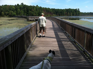
What is Sammy looking at while crossing the bridge? Could there be a troll under the bridge?
Tons of turtles! Well, maybe not tons--but dozens of them!

Wish you were here,
Joyce
Sammy & PG


Sunday, September 1, 2013

Yorktown Market Days, Yorktown & Newport News Park, Newport News, VA

First day of my "Stay-cation" so I thought I'd take the dogs out for the day. First we went to Yorktown Market Days. Take I-64 to exit 250B. Continue on Ft. Eustis Blvd. for 3 miles and turn left onto Route 17 North/George Washington Memorial Highway. Follow Route 17 North to the second traffic light and turn right onto Cook Road. Follow Cook Road to Ballard Street. Turn left on Ballard Street. There is a parking lot on Ballard Street and then you can walk down the hill to the marketplace.
At the bottom of the hill, you'll come to the field with the marketplace. It's a pretty place with the York River in the background.
There are a few produce stands, but also breads, jams, fresh seafood, beef, pork and poultry. You can do all your shopping in one place. The weekly market will be open till the end of September.
PG was pretty hot, though! Her tongue was almost touching the ground! So after we had all of our produce in our cooler bag--we headed off to the Newport News Park. We had been there a few weeks ago and I wanted to go back and walk on the longer trail.
So, we headed off on the White Oak Trail. It's a 2.6 mile trail that starts out at the bridge over the dam. Plenty of signs to keep you on the right trail.
We looked out to the right and could see three big swans.
The paths were shady but I would say this is a medium level difficulty trail. There are some elevation changes and lots of roots on the path.

At one point on the trail we came across this tree that looked like a bear up in the tree! It was just the way the tree was growing!
At about the halfway point there is a swamp. There is a bridge over the swamp. Lots of cat tails!
We ended up the walk with Sammy coming almost face to face with a doe. Both dogs were very tired and happy to get home.

Wish you were here!
Joyce
Sammy & PG


Saturday, August 24, 2013

Lafayette Park, Norfolk, VA

I had to do a greyhound home visit in Norfolk this morning, so thought I would look for a nearby park for us to explore. I decided to go to Lafayette Park on Granby Street right next to the Virginia Zoo.
Lafayette Park is one of the oldest parks in the City of Norfolk. In 1899, the city officially opened it, and a year later, the park began acquiring animals to put on exhibit. By 1901, the Lafayette Park zoo had acquired over 200 animals including mammals, reptiles and birds. We could see one of the animals, some kind of an African herd animal, through the bamboo but it's very hard to see in our photo. It's kind of a light brown blob on the right hand side of the photo below!
 In the early 1900s, visitors could drive their cars through the park and look at the animals. It wasn't until the late 1960's when the zoo was fenced off from Lafayette Park.
The park is very shady, with lots of paths to walk on. It also has a playground, basketball courts, soccer field, tennis courts, picnic pavilions and rest rooms. There are a lot of homeless people at this park--I don't think I'd feel safe after dark--but on this bright, sunny morning it was OK.

If you walk along the north edge of the park and zoo, there is a boat ramp to the Lafayette River. We met several gentlemen fishing for croaker at the boat ramp.
Sammy and PG weren't interested in going into the river. I guess the day wasn't hot enough for them to want to splash around.
The Lafayette River was originally known as Tanner's Creek. Tanner's Creek was renamed the Lafayette River at about the same time Lafayette Park was established. River and park were named in honor of the Marquis de La Fayette, a French Army officer who became a popular American Revolutionary War hero.

J'aimerais que tu sois là (wish you were here!),
Joyce
Sammy & PG


Saturday, August 17, 2013

Newport News Park, Newport News, VA

Just off Interstate 64 at Exit 250B--you will find Newport News Park. What a treasure!
This 8,000 acre park is one of the largest municipal parks in the country. It is beautifully maintained with manicured landscaping all around. The picnic shelters all have nice pavers and look more like  outdoor cafes rather than a picnic pavilions.
We made a wrong turn when we first got there and ended up by the Disc Golf course. We went on a short walk past an old Japanese tea house. It is surrounded by a stream with a waterfall. I've been looking for a path with a waterfall--who knew there was one right in Newport News!
We left that area and drove a little farther into the park to the Discovery Center.
I recommend going here to start out. There are a number of trails that start from this point. For history lovers, Newport News Park is the site of some of the best preserved Civil War fortifications, earthworks and redoubts in Virginia, and is a designated stop on the official Virginia Civil War Trails network.  There are signs on the trails explaining different battles.
The path is sand or gravel covered and level so it's easy to walk on. There are hardly any elevation changes but there are lots of roots across the path that you have to watch out for. We walked on the Discovery Center trail.
We came across some wildlife--a mole poked its head out at the wrong moment as we were walking by. PG snatched it up, shook it and killed it. At the end of the trail, we came across 4 deer. Hounds that instinctively want to chase game are very excited when they come into contact with deer! And the deer are so used to people--they didn't even run away. An exciting end to the walk!
When we go back, we're going to walk on the White Oak Trail. It's a 2.4 mile trail around the lake.  Maybe we'll do that in the fall when the leaves are changing--it should be beautiful!

Wish you were here!
Joyce
Sammy & PG


Sunday, July 28, 2013

Fort Boykin Park, Smithfield, VA

Today we ventured to Smithfield to go to the very secluded Fort Boykin Historical Park. How to get here? From downtown Smithfield--head northwest on Church Street, go past the Smithfield Packing Plants, turn right on Blounts Corner Road, turn right on Morgart's Beach Road (which is a dirt road) and in about 2 miles you'll find the park on the left.
The parking area and the picnic area are together.
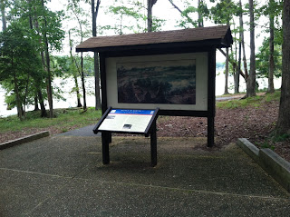
There is a sign that explains a little history of the park. It's been around since1623 when a fort known as the Castle was constructed to protect the Jamestown colonists from Native Americans and raiding Spaniards. Atop a bluff overlooking the James River, the site’s commanding view makes it a keen observation point. Fort Boykin was re-named during the Revolutionary War after Maj. Francis Boykin, a local merchant who served on Gen. George Washington’s staff and who owned the property.
Between June 1861 and May 1862, the Confederate Army rebuilt the fort as a part of their defensive system. It was one of in a series of earthworks designed to prevent inland invasion by the Union, whose buildup at the mouth of the James River posed a severe threat to Richmond, the Confederate capital. So the entrance to the park is up over some very steep steps that go over the earthworks. Greyhounds normally have trouble with steps that steep--but mine took the steps in a few leaps.

There really are no paths, other than the concrete walkway down to the beach area. The whole park is very shady with lots of old trees so it's a nice place to walk in the hot summertime.
The beach on the James River is very secluded, too. There was a man swimming with a lab and a Rottweiler--they were the only ones we saw during our whole time there.
Sammy and PG enjoyed going into the water for a dip. I probably could have let them go swimming--but I'm not sure how well they swim.

Fort Boykins is on the Virginia Birding and Wildlife Trail. It is part of the eBird System, the bird database run by the Cornell Lab of Ornithology and the National Audubon Society. And, Fort Boykin is home to the commonwealth’s second oldest black walnut tree. This tree, over 200 years old, has been named to the Remarkable Trees of Virginia Project.

Wish you were here,
Joyce
Sammy & PG


Monday, June 24, 2013

Riverwalk Trail, Rock Hill, SC

This weekend we went to visit family in South Carolina, just over the border from North Carolina, very close to Charlotte. I found this new trail for the dogs.
It is a part of the Carolina Thread Trail system. The Carolina Thread Trail system is a series of trails throughout the Carolinas open to the public that connects people, cities and towns. The Riverwalk Trail is in a housing development--but right along the river--keeping that portion of the development open to all.
The trail starts out at a canoe/kayak launch. It is easy to find--right off Cherry Road in Rock Hill.
This is a beautiful trail along the river. It's paved and has a few elevation changes--but pretty easy to walk. Mountain bikes go on the trail, too--so you have to be aware of them passing.
There is a 10 mph speed limit, though, Sammy! No running!
All along the trail, you can view the Catawba River. People are canoeing and kayaking. Lots of birds.
The trail goes 4.25 miles out and back; it doesn't loop around. We walked a mile in and then turned around and walked back out because it was humid and the dogs were hot.  The trail is marked every 1/4 mile so you can decide when to turn around.

On the way back, Sammy and PG went into the river for a dip. They loved that part of the walk!


 Sammy really enjoyed the water!
http://www.youtube.com/watch?v=TCEh8B6qQOQ

I have to add another note about our trip. I tried to walk at Cherry Park, also in Rock Hill. I walked there in December the last time I visited. But this time, when I walked at Cherry Park I was stopped by one of the park rangers and told there was a "one dog per person" rule. Since I had more than one dog, I had to leave! Isn't that a crazy rule? The ranger said the people who have more than one dog never pick up after their dogs. I pulled out a handful of poop bags from my purse! Then he said that people are afraid of dogs and when someone walks more than one dog, it's really scary. I said, Well, I'm going to have to put this on my blog! One dog per person. He said, Please don't write anything bad about our park on your blog! So, if you only have one dog--Cherry Park is a nice place to walk. But if you have more than one dog, go to Riverwalk Trail!

Also while we were in the Charlotte area, we went to several dog friendly restaurants. One was Toast Cafe. This cafe was in the Ballentyne area of Charlotte. They are only open for breakfast/brunch from 8am till 2:30pm.
The dogs were welcome on the patio. The waitress brought water for both dogs. And refilled it at the same time as she refilled the other waters at the table!
Overall, Charlotte, NC and Rock Hill/Fort Mill, SC are very dog friendly areas!

Wish you were here!
Joyce
Sammy & PG